|
|
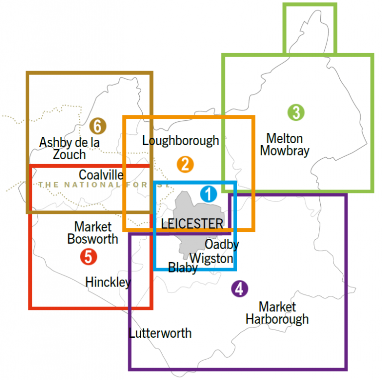
Take a look at our interactive cycle map or download one of the maps below to explore your local area, and beyond!Please email ChooseHowYouMove@leics.gov.uk if you require further any assistance.
|
1) Leicester North
The city centre is brimming with things to do and places to eat, shop or visit. Follow National Route 63 into Leicester or National Route 6 to Watermead Country Park.
For further information:
No1_Leicester_City_North (JPEG, 1 MB)
1) Leicester South
Explore the south of the city and its suburbs, or venture a little further out into Leicestershire county. Follow National Route 6 to get to Leicester South.
For further information:
No1_Leicester_City_South (JPEG, 1 MB)
2) Loughborough and Shepshed
This town is home to a street market dating back to 1221 and boasts several green spaces. Follow National Cycle Network 6 to Loughborough.
For further information:
Loughborough and Shepshed (JPEG, 985 KB)
2) Borough of Charnwood
Explore one of several green spaces in Charnwood such as Beacon Hill in Charnwood Forest, or visit Charnwood Museum to delve into some local history.
For further information:
Charnwood (JPEG, 1 MB)
3) Melton Mowbray
This historic town in north-eastern Leicestershire has a wealth of historic and beautiful parks. Follow National Cycle Network Route 64 which passes through the heart of Melton Mowbray.
For further information:
Melton Mowbray (JPEG, 944 KB)
3) Borough of Melton
Head south on National Cycle Network Route 64 from Melton Mowbray on the Gartree Ride, and visit Burrough Hill Iron Age fort; one of the borough’s most historic features.
For further information:
Borough of Melton (JPEG, 835 KB)
4) Market Harborough
This town is home to the ‘Millenium Mile’, linking the town centre’s shops with Welland Park. Follow National Cycle Network route 64 into Market Harborough.
For further information:
Market Harborough Cycle Map (PDF, 2 MB)
4) Harborough District
Follow Route 6 which winds out of the town along the Grand Union Canal towards Leicester, taking in Foxton Locks; a staircase of ten locks and a great place to stop off for a refreshment.
For further information:
Harborough District (JPEG, 919 KB)
5) Hinckley & Burbage
These towns are surrounded by many of Leicestershire’s prettiest villages and rolling countryside. Hinckley has lots of recommended on and off-road cycle routes to help you get around town.
For further information:
Hinckley and Burbage (JPEG, 1012 KB)
5) Borough of Hinckley & Bosworth
The area is home to Bosworth Battlefield and its award winning Heritage Centre. The site features some fantastic walking and cycling routes, just off of the National Cycle Network route 52.
For further information:
Borough of Hinckley and Bosworth (JPEG, 1 MB)
6) Coalville Town Area
This town lies in the heart of The National Forest, and just a short ride south of the town centre is the 1620s House and Garden at Donington le Heath. Follow National Cycle Network route 52 for Coalville.
For further information:
Coalville Town Area (JPEG, 890 KB)
6) North West Leicestershire
To the north of Coalville is where National Cycle Network Route 52 meets Route 6, where you can head towards Worthington to join the Cloud Trail, a 13 mile route into Derby.
For further information:
North West Leicestershire (JPEG, 1 MB)