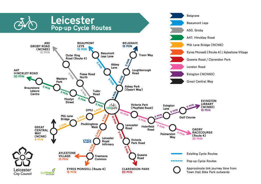
Leicester’s Cycling Tube Map
This is Leicester’s very own London-style Tube Map of new and existing cycle routes in the city. The map uses different coloured routes to set out the main cycle paths connecting key residential and employment areas of the city, to Leicester city centre. This map presents existing and new pop-up cycle tracks, which can be identified using the map key.
Around 11 miles of pop-up cycle routes have been installed over a 10 week programme as part of Leicester City Council’s Covid-19 Transport Recovery Plan. These new routes provide commuters with safer, wider, segregated cycle lanes as an alternative to using public transport, and also to encourage more people to use sustainable forms of transport.
At the centre of the new map is Leicester’s Town Hall Bike Park, and each route is marked with approximate travelling time between important locations along the route. Read more or see a full list of new pop-up lanes.